
The landscape of physical commerce has reached a definitive turning point where the ability to interpret human movement is as critical as managing inventory levels. Consolidating sensing hardware into a streamlined LiDAR system significantly lowers the total cost of ownership by reducing long-term maintenance requirements. In the current market, the focus has shifted from simple foot traffic counting to the broader concept of spatial intelligence, which involves extracting high-fidelity behavioral data from complex physical environments. By leveraging advanced sensors such as the Hesai XT32 alongside sophisticated analytics platforms like SAIMOS, retailers are now able to monitor visitor trajectories, dwell times, and heatmapping with an efficiency that was previously unattainable. This transition represents a major departure from legacy monitoring setups that required a dense, intrusive footprint of hardware to achieve even a fraction of the data quality that modern 3D LiDAR solutions provide today. As retail spaces become more dynamic and architectural designs more intricate, the demand for non-intrusive, high-precision sensing has positioned LiDAR as the foundational technology for the next generation of store optimization and customer experience management.
Legacy Infrastructure: The Limitations of Optical Sensing
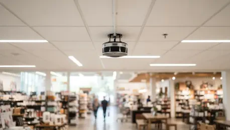
Traditional retail monitoring systems have long relied on high-density networks of stereo cameras, but these architectures are increasingly proving to be a bottleneck for large-scale operations. When a major retail project requires nearly 200 ceiling-mounted cameras to cover a single facility, the physical and digital infrastructure needed to support such a network becomes a liability. These legacy systems are highly susceptible to physical obstructions common in modern store designs, such as complex lighting fixtures, suspended decorative elements, and HVAC ductwork that can easily block a camera’s line of sight. Furthermore, the sheer volume of hardware creates a massive demand for supporting equipment, including miles of specialized cabling and dozens of high-capacity network switches. This infrastructure bloat not only complicates the initial installation but also creates a long-term maintenance burden that can quickly exceed the operational budget, making it difficult for retailers to maintain a consistent level of data accuracy across their entire footprint as the physical space evolves over time.
Beyond the physical challenges of mounting and maintaining hundreds of cameras, the digital overhead of processing 180 or more individual video feeds is often prohibitive. Each camera requires a dedicated stream that consumes significant network bandwidth and necessitates massive server capacity to handle the real-time image processing required for tracking people. In many cases, the labor costs associated with installing and calibrating such a large number of sensing points make the project financially unviable from the start. The complexity of “stitching” together hundreds of individual 2D views to create a cohesive understanding of customer flow often leads to tracking errors, especially at the edges of a camera’s field of view. This technological ceiling has forced a reevaluation of how spatial data is collected, leading many industry leaders to abandon the high-density camera model in favor of a more streamlined approach that prioritizes data quality over the quantity of sensors. By moving away from these bloated architectures, businesses are finding they can achieve higher precision with a fraction of the hardware previously thought necessary.
Technical Superiority: The Precision of 3D LiDAR Integration
The transition to 3D LiDAR technology represents a fundamental shift in how depth and movement are perceived within a physical environment. Unlike standard optical cameras that capture two-dimensional images and require complex algorithmic estimations to determine distance, LiDAR—short for Light Detection and Ranging—emits laser pulses to create a high-resolution 3D point cloud of the surroundings. This native 3D data allows the system to distinguish between human beings and inanimate objects, such as shopping carts or display kiosks, with a level of accuracy that stereo cameras struggle to match. The Hesai XT32 sensor, in particular, has become a benchmark in this field because it provides the necessary point-cloud density to track individual movement paths without overwhelming the network with excessive data. This inherent dimensionality means that lighting conditions, whether it be harsh midday glare or dim evening ambiance, have no impact on the sensor’s performance, ensuring that spatial intelligence remains consistent regardless of the store’s environmental variables or promotional lighting setups.
Positional accuracy is perhaps the most compelling technical advantage of incorporating LiDAR into a retail environment, as these systems frequently achieve a precision level of better than 10 centimeters. This degree of granular detail is essential for high-level analytics, such as determining the exact dwell time of a customer at a specific shelf or measuring the effectiveness of a temporary promotional display. When tracking individual paths across a large area, LiDAR sensors eliminate the common “hand-off” errors that occur in multi-camera setups where a person might be lost or double-counted when moving from one camera’s zone to another. By using an optimized sensor like the XT32, the system maintains a high-fidelity digital twin of the store’s activity in real time, providing the SAIMOS analytics platform with a clean, accurate data stream. This precision allows store managers to move beyond general trends and gain a surgical understanding of how every square foot of the retail floor is being utilized, which is the cornerstone of effective spatial intelligence and modern operational strategy.
Infrastructure Efficiency: Massive Reductions in Hardware Footprint
One of the most immediate and tangible benefits of adopting 3D LiDAR is the staggering reduction in the physical hardware required to cover a given area. In real-world retail deployments, it has been demonstrated that as few as 12 LiDAR sensors can successfully replace a network of 180 stereo cameras while providing even more reliable coverage. For instance, on a typical retail floor measuring 110 meters by 20 meters, just four Hesai sensors can provide seamless, gap-free monitoring of the entire space. This 93% reduction in the number of sensing points fundamentally changes the economics of the deployment, as it drastically lowers the requirements for cabling, power-over-ethernet switches, and overall network bandwidth. By streamlining the sensing layer, retailers can focus their resources on the quality of the data and the resulting insights rather than the constant management of a massive hardware fleet. This shift toward “less is more” ensures that the technology remains a tool for growth rather than a burden on the IT and facilities departments.
The economic impact of this hardware consolidation is profound, often resulting in direct capital savings of hundreds of thousands of dollars. Reports from recent installations show that switching to a LiDAR-based architecture can save a project upwards of €200,000 when accounting for hardware costs, software licensing, and server requirements. Because there are fewer devices to connect and manage, the labor costs associated with installation and long-term maintenance are slashed, allowing for a much faster return on investment. Furthermore, a smaller hardware footprint means a more sustainable IT environment with lower power consumption and reduced electronic waste over the lifecycle of the system. This reduction in the total cost of ownership makes sophisticated spatial intelligence accessible to a wider range of retail environments, from boutique luxury stores to massive flagship locations, without the need for the prohibitive infrastructure budgets that were once a barrier to entry for high-precision behavior analytics.
Operational Flexibility: Adapting to Dynamic Retail Environments
Retail spaces are famously fluid, requiring frequent layout changes to accommodate seasonal shifts, new product arrivals, and temporary promotional booths. Traditional camera-based systems often struggle with these changes, as moving a shelf or adding a tall display can create new blind spots that require the repositioning or recalibration of multiple cameras. In contrast, 3D LiDAR sensors provide wide-area, 360-degree coverage that is inherently more resilient to physical changes within the store. The broad field of view offered by sensors like the XT32 means that the physical sensing layer rarely needs to be adjusted, even when the retail floor is completely reorganized. This operational flexibility allows store managers to experiment with different layouts and merchandising strategies without worrying about degrading the quality of their movement data. The technology stays out of the way of the business, providing a consistent baseline of spatial intelligence that adapts as quickly as the retail environment itself.
The use of geotemporal analytics within the SAIMOS platform further enhances this flexibility by allowing operators to query historical patterns even after the physical layout of the store has been altered. This capability means that a manager can compare current foot traffic in a specific aisle with data from months prior, regardless of whether the shelves or display booths have been moved in the intervening time. By storing spatial data in a way that is indexed to the physical coordinates of the room rather than the specific view of a camera, the system creates a persistent record of behavior that remains useful over the long term. This longitudinal data is invaluable for evaluating the success of different floor plans and understanding how architectural changes impact customer dwell time and flow. Furthermore, because LiDAR naturally protects privacy by generating point clouds instead of high-resolution video of faces, it allows for this deep behavioral analysis to occur in a way that is ethically sound and compliant with global data protection standards, ensuring the system is future-proof from both a technical and a regulatory standpoint.
Strategic Insights: Transforming Raw Data Into Actionable Intelligence
The ultimate goal of implementing a 3D LiDAR system is to move beyond the collection of data and arrive at actionable business intelligence that improves the bottom line. By processing high-precision spatial data through an advanced control center, retail operators can access a variety of sophisticated analytics, including detailed heatmaps and pathing visualizations. These tools allow managers to identify “dead zones” that receive little traffic and optimize the placement of high-margin items in areas where customer density is naturally higher. Understanding the specific routes customers take through a store helps in refining the overall aisle architecture and reducing friction in the shopping experience. When this data is used to optimize the placement of service counters or promotional end-caps, the result is a more efficient use of floor space and a direct increase in customer engagement. These insights transform the physical store from a static environment into a measurable, optimized platform for commerce.
Strategic planning and personnel management are significantly enhanced by the transition to these streamlined LiDAR-based architectures. The ability to monitor real-time situational awareness means that staff can be deployed more effectively to high-traffic areas exactly when they are needed, improving service efficiency and customer satisfaction levels. Decisions regarding floor plan modifications are no longer based on intuition but are driven by hard data that quantifies exactly how long visitors spend interacting with specific displays. The successful integration of these systems proved that LiDAR is a mature and highly viable solution for the retail sector, offering a level of precision and operational savings that legacy cameras could not match. Moving forward, the focus for retail leaders should be on the integration of these spatial datasets into broader business intelligence ecosystems to further refine the human experience in physical spaces. By adopting a “privacy by design” approach and reducing the technical footprint of their stores, organizations have established a new benchmark for how modern retail intelligence should be conducted in an increasingly data-driven world.